Description
Standard photos show the home.
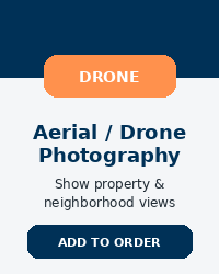
Aerial photos show the property.
Drone photography provides a dramatic overhead perspective that highlights features traditional photos cannot capture — lot boundaries, waterfront views, acreage, surrounding amenities, and neighborhood context.
This upgrade is especially powerful for:
-
Large lots
-
Corner properties
-
Waterfront homes
-
Homes near parks or amenities
-
Properties with unique landscapes
What’s Included
-
Professional aerial photo session
-
Multiple elevation angles
-
Edited, MLS-ready images
-
High-resolution delivery
-
Unbranded format for compliance
No preset image cap — the focus is complete property coverage.
Why Sellers Add This
-
Enhances perceived value
-
Makes listings stand out in search results
-
Increases engagement on MLS and syndication platforms
-
Provides premium marketing without full-service commission
Important Notes
-
Subject to weather and airspace conditions
-
Conducted in compliance with local and federal guidelines
-
Not required, but highly recommended for properties with land or views


Reviews
There are no reviews yet.